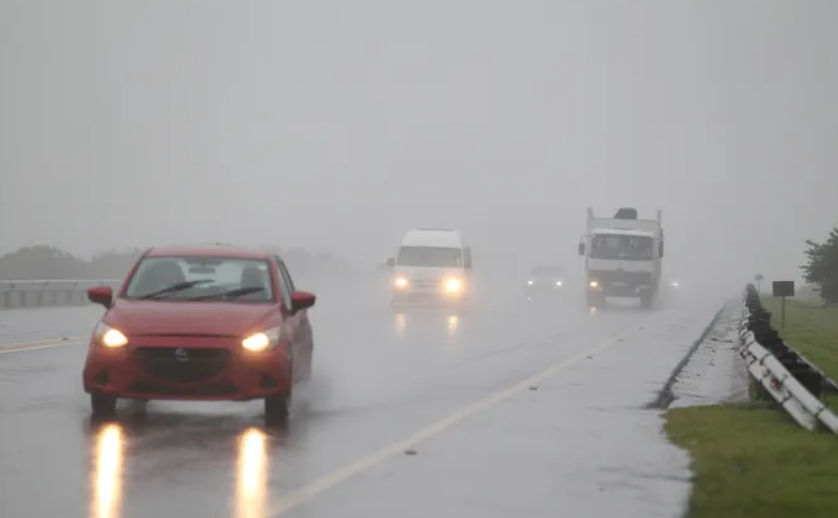
The South African Weather Service (SAWS) has issued a Level 6 warning for disruptive rainfall along parts of the eastern seaboard, cautioning that severe flooding of bridges, roads and settlements is likely between East London in the Eastern Cape and Cape Vidal in northern KwaZulu-Natal.
The warning signals a high probability of significant impacts, including damage to property and infrastructure along the coast and adjacent interior regions. Authorities have urged residents in low-lying areas to remain vigilant as heavy downpours are expected to intensify from Wednesday evening.
In addition to the heavy rain alert, SAWS has also issued an Orange Level 5 warning for disruptive snowfall over the extreme north-eastern high ground of the Eastern Cape. Forecasters say accumulating snow in these areas could cause traffic disruptions, interrupt essential services and temporarily isolate some communities.
A Yellow Level 2 warning for disruptive snowfall has been placed over the north-eastern high ground of the Eastern Cape and the Drakensberg region of KwaZulu-Natal, where lighter snowfall is anticipated.
Flooding and Infrastructure Damage Possible
The Level 6 rainfall warning is particularly concerning for coastal communities and inland settlements already vulnerable to flooding. SAWS has indicated that bridges and roads may become submerged, while informal settlements face the risk of water damage and displacement.
A Yellow Level 2 warning for disruptive rainfall has also been issued for the south-eastern parts of the Eastern Cape and the eastern parts of KwaZulu-Natal, excluding the province’s extreme north-east. In these areas, localised flooding of roads and settlements is possible, along with damage to infrastructure.
The weather service warned that persistent rainfall could overwhelm drainage systems and lead to hazardous travel conditions, particularly along major transport routes.
Very Cold and Wet Conditions
Forecasters say a cut-off low pressure system is driving the severe weather pattern. Very cold and wet conditions are expected to set in from Wednesday evening across parts of the Eastern Cape, southern KwaZulu-Natal, the southern Free State and areas bordering Lesotho.
Light snowfall is forecast in these regions as the system moves through. Conditions are expected to begin clearing from the west on Thursday as the weather system gradually weakens.
Farmers in affected areas have been advised to take precautionary measures to reduce potential losses, particularly where livestock and crops may be exposed to prolonged cold and wet weather.
Provincial Breakdown
Across the country, conditions will vary significantly:
- Gauteng is expected to be partly cloudy and cool to cold, with isolated showers and rain.
- Mpumalanga and Limpopo can expect drizzle along the escarpment, accompanied by cool conditions and isolated showers.
- The Free State is forecast to be cold, with isolated to scattered showers and thundershowers. Light snowfall is possible along the Lesotho border.
- The Northern Cape will experience cold to cool weather, with very cold conditions in the southern parts and isolated to scattered showers in the south-east. Light snowfall is also possible in the province’s extreme south-east.
- The Western Cape is expected to remain fine to partly cloudy and cool to warm, although parts of the Central Karoo will be cold.
- The Eastern Cape will be cloudy and cold to very cold, with widespread rain in the eastern half and snowfall over high-lying areas.
- KwaZulu-Natal will remain cloudy and cold to cool, with scattered showers and rain. The extreme north-east of the province is expected to receive only isolated rainfall.
Despite the widespread adverse weather alerts, SAWS confirmed that no fire danger warnings are currently in effect.
Public Urged to Exercise Caution
Residents in affected regions have been urged to monitor official weather updates and avoid unnecessary travel during peak rainfall periods. Motorists are advised to reduce speed, increase following distances and avoid crossing flooded bridges or roads.
Emergency services and disaster management teams are expected to remain on high alert as the system moves across the eastern parts of the country.
With both heavy rainfall and snowfall forecast over the coming days, authorities are appealing to communities to take precautionary steps to safeguard lives and property as winter conditions tighten their grip over large swathes of South Africa.