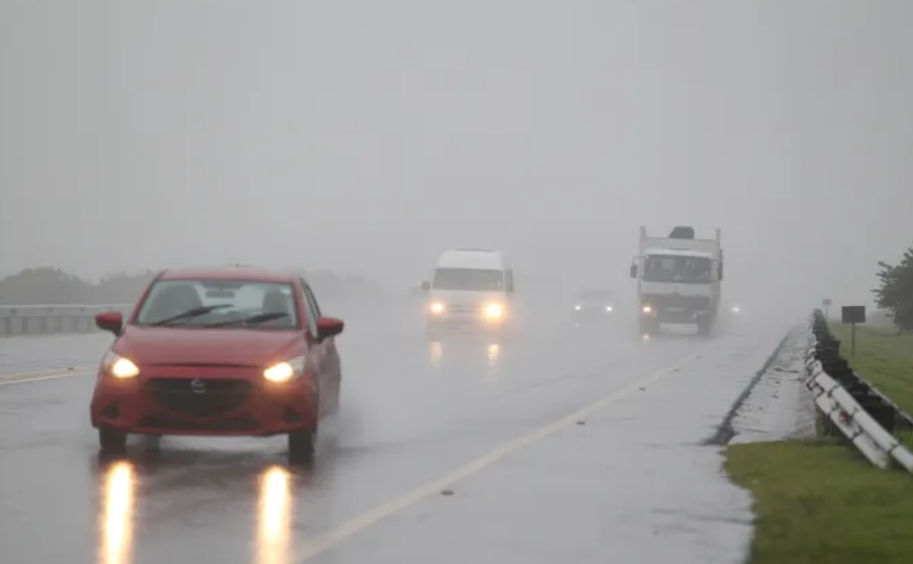
A volatile weather system is expected to sweep across much of South Africa on Thursday, bringing a broad swathe of showers and thundershowers and raising the risk of flooding, infrastructure damage and treacherous travel conditions, particularly over the interior.
Forecasters warn that while rain and storms will be fairly widespread, the greatest concern is centred over the central and north-eastern interior, where severe thunderstorms are expected to develop through the course of the day. These storms are likely to pack heavy downpours, large hail, intense lightning and strong, damaging winds – a combination that significantly increases the danger to both people and property.
The North West province lies squarely in the firing line. Here, widespread rainfall chances sit at around 80%, supported by a Yellow Level 4 warning for severe thunderstorms. A Level 4 alert is one of the higher impact categories and signals a strong likelihood that storms will disrupt normal activities and may cause damage, particularly in vulnerable or poorly serviced areas.
In the North West, these severe storms are expected to be intense and slow-moving enough to produce localised flooding of streets, low-lying bridges and informal settlements. There is also a heightened risk of damage to roofs, vehicles and crops from large hail, as well as fallen trees and power lines due to strong winds. Intense lightning poses a further threat to outdoor activity, livestock and infrastructure.
Other inland provinces will not escape the system’s effects. Gauteng, Limpopo and the northern parts of the Free State are all forecast to experience significant storm activity, with rain probabilities broadly in the 60% to 80% range in many areas. A Yellow Level 2 warning is in place here, signalling the potential for impactful but more localised severe weather.
Under the Level 2 alert, storms may still cause disruptive conditions, including localised flooding of roads and low-lying areas, especially where drainage is poor or stormwater systems are blocked. Isolated damage to property and infrastructure is possible, along with hazardous driving conditions as visibility drops in heavy rain and on waterlogged roads.
Across Gauteng, conditions are expected to be largely cloudy and cool for most of the day, with showers and thundershowers becoming more widespread towards the north. Motorists are likely to encounter wet roads on key routes including the N1, N3, N12 and R21, particularly from late morning into the afternoon and evening. Short-lived but intense downpours may cause ponding and flash flooding in typical hotspots such as low-lying intersections and underpasses.
Further east, Mpumalanga and much of Limpopo will also come under the influence of the system. These provinces are forecast to see cloudy, cold to cool conditions, with scattered showers and thundershowers developing as the day progresses. In western Limpopo, the activity is expected to be more widespread, suggesting a greater risk of persistent rain and thunderstorms over a wider area.
Morning fog along the escarpment in Mpumalanga and parts of Limpopo may reduce visibility significantly early in the day, making for challenging driving conditions even before thunderstorms arrive. As the fog lifts, convective clouds are likely to build, setting the stage for afternoon and evening storms.
The Free State faces a gradient of conditions from south to north. The province as a whole is expected to remain mostly cloudy, windy and cool under the influence of the broader system. In the south, rain chances sit at around 30%, rising to about 60% across the northern half. This means that while some southern areas may see only light or intermittent showers, the northern Free State is more likely to experience repeated showers and thundershowers, including the risk of heavier bursts.
To the west, the Northern Cape presents a more divided picture. The far western parts of the province are expected to remain largely dry, with little to no rainfall anticipated. However, central and north-eastern regions of the Northern Cape could see a 30% to 60% chance of showers and thundershowers as the system pushes further inland. Here too, isolated strong cells cannot be ruled out, particularly in areas bordering the Free State and North West.
Along South Africa’s coastline, the main hazards shift from rain and lightning to wind and waves. Marine forecasts point to strong winds and rough seas from Alexander Bay on the west coast to Plettenberg Bay along the southern coastline. A Yellow Level 2 warning is in place for this stretch during the morning, indicating that conditions at sea and along exposed stretches of coast may become dangerous for small vessels, rock anglers and beachgoers.
Further east, from Oyster Bay to Algoa Bay, a separate Yellow Level 1 warning has been issued. While less severe than Level 2, this alert still warns of wave activity strong enough to disrupt small harbours, launch sites and beachfront operations. Swell and wind-driven waves may cause hazardous conditions for small craft and could lead to beach erosion or overtopping in susceptible spots.
In stark contrast to the unsettled weather elsewhere, the Western Cape is expected to remain largely dry and stable under the influence of a different air mass. Inland areas should experience fine and warm conditions, while only partial cloud is forecast along sections of the south coast. Rainfall prospects in the Western Cape are essentially nil for Thursday.
However, the calmer conditions bring their own risk: a very high UVB index is anticipated under the clearer skies, meaning unprotected skin can burn quickly. Residents and visitors are advised to take standard sun protection measures if spending extended periods outdoors.
The Eastern Cape, straddling the transition between the interior storm belt and the more settled western regime, faces a mixed outlook. The western half of the province is set to remain mostly fine, with comparatively little rainfall expected. By contrast, the eastern half – particularly along the Wild Coast and northern interior – is forecast to be cloudy, with around a 30% chance of showers and light rain.
These showers may be patchy and generally lighter than those in the interior, but could still affect visibility and road conditions at times, especially along coastal and escarpment routes.
With large parts of the country under some level of weather alert, authorities typically advise residents to remain alert to official updates, avoid crossing flooded roads or bridges, secure loose outdoor items ahead of strong winds, and exercise caution when travelling in heavy rain, fog or lightning.