

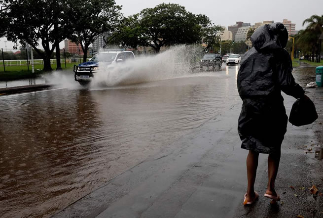
South Africans are being warned to prepare for a cold, wet and stormy Monday, with severe thunderstorms expected to sweep across parts of the country and bring heavy rain, damaging winds, large hail and dangerous lightning.
The most serious warning is an Orange Level 6 alert for severe thunderstorms. Between 30mm and 50mm of rain could fall in affected areas, while winds may exceed 40km/h. Stronger gusts are also possible, raising the risk of fallen trees, damaged structures and power interruptions.
The South African Weather Service has warned that the storms could create dangerous conditions on roads and in vulnerable communities. Localised flooding is possible, particularly on roads, at low-lying bridges and in informal settlements. Motorists may also face traffic disruptions, poor visibility and rapidly changing road conditions as the rain moves across the interior.
Residents are being urged not to underestimate the storm system. Heavy rain can turn a familiar route into a flooded stretch of road within minutes, while hail and lightning can make travelling especially risky. People living in areas affected by the warning should take precautions before the worst weather arrives and should avoid crossing flooded roads or bridges.
The Orange Level 6 warning covers areas where the combination of intense rain, powerful winds, hail and lightning could cause serious disruption. In addition to flooding, the storms may damage buildings, bring down trees and affect electricity supplies. Informal settlements are considered particularly vulnerable because heavy rain can quickly flood homes and access routes.
A separate Yellow Level 2 warning has been issued for parts of the North West and Free State, as well as areas along the Lesotho border. These regions could experience localised flooding and strong winds, with residents advised to remain alert as conditions develop.
Gauteng Braces For Cold Showers And Thunderstorms
Gauteng is expected to be cloudy and cool, with scattered showers and thundershowers across the province. The province could see difficult travel conditions during periods of heavy rain, especially in built-up areas where stormwater systems may struggle to cope with a sudden downpour.
Johannesburg is expected to record a low of 10°C and a high of 14°C. Pretoria should range between 13°C and 16°C, while Soweto is expected to see temperatures of between 11°C and 15°C.
The combination of low temperatures and wet conditions will make for a miserable start to the week for many residents. People travelling early in the morning should be prepared for cold roads, wet surfaces and reduced visibility, while those returning home later in the day should watch for thunderstorms and possible flooding.
Free State And North West Face Heavy Rain
The Free State will remain overcast, cool and wet. Heavy rain is possible, particularly over the central and eastern parts of the province, where the weather could become unsettled for long periods.
Bloemfontein is expected to record temperatures between 10°C and 19°C. Welkom should range from 12°C to 19°C, while Bethlehem is expected to be much colder, with a minimum of 9°C and a maximum of 13°C.
In the North West, cool conditions, widespread rainfall and moderate to strong winds are expected. Mahikeng is forecast to range from 14°C to 20°C, Rustenburg from 13°C to 19°C and Potchefstroom from 12°C to 19°C.
The weather could affect road users across both provinces, particularly where rain collects on roads or where strong winds make driving difficult. Residents in low-lying areas should remain cautious and keep away from swollen streams and flooded crossings.
KwaZulu-Natal Could See Widespread Rain
KwaZulu-Natal is also expected to experience cold to cool conditions, with widespread rain and scattered thundershowers. Durban should record temperatures between 16°C and 21°C, while Pietermaritzburg is expected to be colder, ranging from 8°C to 18°C. Ladysmith should see temperatures between 9°C and 16°C.
Thunderstorms may bring sudden bursts of heavy rain, making conditions difficult for people on the roads and for communities in areas where flooding is a regular danger. Residents should take care near rivers, streams and low-lying bridges, particularly if rain continues for several hours.
Limpopo is expected to see partly cloudy to cloudy conditions, with isolated showers. Polokwane should range from 12°C to 18°C, while Musina is expected to be warmer, with temperatures between 17°C and 23°C.
Eastern Cape And Northern Cape Weather Outlook
The Eastern Cape will experience cool conditions, with scattered showers expected inland and along the coast. Gqeberha is forecast to record a low of 15°C and a high of 23°C, while East London should range from 16°C to 21°C.
The Northern Cape will see conditions ranging from cold to warm. Severe thunderstorms are possible in the eastern parts of the province, while the western areas are expected to remain sunny and dry. Kimberley should experience temperatures between 11°C and 22°C, with Upington much warmer at between 12°C and 27°C.
The sharp difference between the eastern and western parts of the Northern Cape means residents should pay close attention to local conditions. While some areas may remain dry, communities in the east could still face heavy rain, hail, lightning and strong winds.
Western Cape Coast Warned About Damaging Winds
Most of the Western Cape is expected to be warm and sunny. Cape Town should range from 15°C to 29°C, while George is forecast to record temperatures between 11°C and 27°C.
However, a Yellow Level 2 warning for damaging winds remains in place along the south-western coast. Strong winds could affect travel, outdoor activities and exposed structures. Coastal residents and visitors should be careful in open areas and should secure loose objects that could be blown around.
Despite the warmer and sunnier conditions in much of the province, the coastal warning shows how quickly weather risks can differ from one part of the country to another. Residents should follow local alerts rather than relying only on the general forecast for the province.
Residents Urged To Take Extra Care On The Roads
Residents in the affected interior areas have been urged to take precautions as the severe weather moves through the country. People should avoid crossing low-lying bridges and should take extra care when travelling through areas experiencing heavy rain or thunderstorms.
Motorists should slow down, keep a safe following distance and remain alert to sudden changes in visibility. Water across a road may be deeper or stronger than it appears, and drivers should never attempt to cross a flooded section when the road ahead cannot be seen clearly.
The risk is not limited to traffic. Strong winds can bring down trees and damage structures, while lightning and power failures can disrupt homes, businesses and public services. Residents should stay indoors during severe thunderstorms where possible and avoid standing near windows, trees, poles or other exposed structures.
Monday’s weather is expected to test communities across several provinces, with the most serious threats coming from flooding, hail, lightning and damaging winds. For many South Africans, the safest decision may be to delay unnecessary travel, stay informed and take the warnings seriously before the skies turn black.