

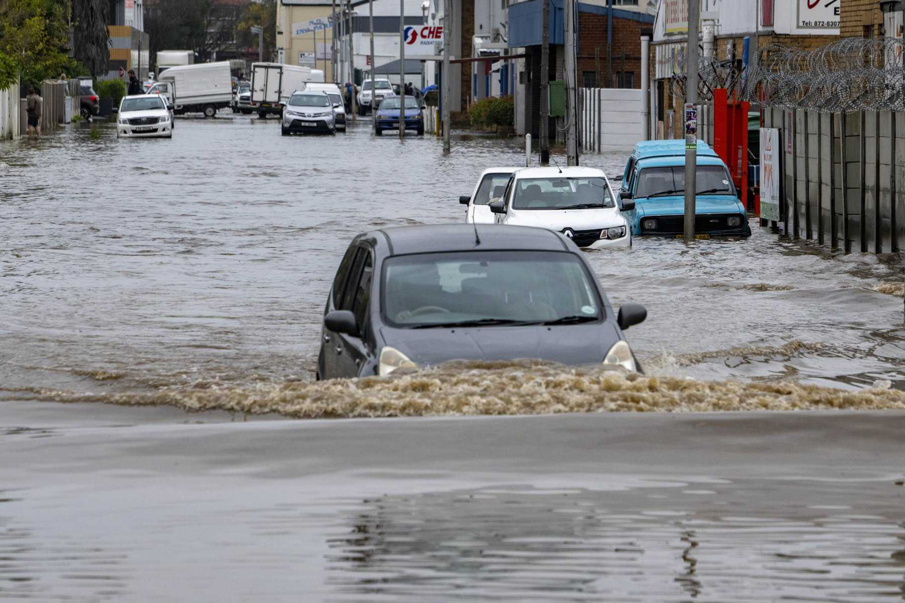
South Africa is bracing for a spell of dangerous weather, with severe thunderstorms, heavy rain, damaging winds, hail and excessive lightning expected across several provinces.
The South African Weather Service has issued an Orange Level 5 warning for the central parts of the Northern Cape, where severe thunderstorms may cause flooding in vulnerable settlements and on roads. The storms are also expected to bring strong gusts, hail, falling trees and damage to structures, while repeated lightning strikes could disrupt municipal services.
A Yellow Level 4 warning covers the central and eastern parts of the Northern Cape and the extreme western parts of North West. Residents in these areas face the risk of localised flooding, strong winds, hail damage, fallen trees and power or service interruptions linked to intense lightning activity.
A further Yellow Level 2 warning has been issued for the Free State and most of North West. Severe thunderstorms in these areas could produce damaging winds and hail, damage buildings and other structures, bring down trees and trigger local fires caused by lightning.
The warnings come as a broad and unsettled weather system affects much of the country. Conditions range from cloudy and cool weather to cold periods, scattered showers, thundershowers and rain. Some areas can expect widespread storms, while others will see isolated activity that may still become dangerous in a short period.
The central and eastern parts of the country are expected to be among the most unsettled. Widespread to scattered showers and thundershowers are forecast in those regions, with isolated storms possible over the western parts. Morning fog patches are also expected in places in the south, reducing visibility on roads during the early hours.
Northern areas are likely to remain cloudy in the morning before conditions improve later in the day. Elsewhere, the weather will range from fine to partly cloudy, with cool to warm temperatures and isolated showers and thundershowers in some places. Along the escarpment, morning fog is expected before the cloud breaks in parts of the region.
The Western Cape and coastal areas will also experience difficult conditions. A warning has been issued for damaging winds and waves between Cape Town and Cape Agulhas, with the possibility of disruption at ports and harbours and dangerous conditions for vessels at sea. The wind along the coast is expected to be fresh to strong from the east and south-east, with gale-force conditions possible along the south-west coast.
On the east coast, a Yellow Level 2 warning is in place for damaging winds and waves between Richards Bay and Kosi Bay. The conditions could disrupt harbour activity and create a danger to navigation. Coastal winds are expected to be fresh to strong from the south and south-west north of Richards Bay at first, before becoming more easterly to south-easterly in other areas. South of Durban, winds are expected to turn north-easterly by late morning and spread towards Cape St Lucia during the evening.
KwaZulu-Natal is expected to be cloudy, cold to cool and affected by isolated showers and rain. The wet and windy conditions may make travel difficult, particularly on exposed roads, near rivers and around low-lying bridges. Motorists have been urged to take extra care where water collects quickly or where strong crosswinds affect high-sided vehicles.
The forecast also includes morning fog along elevated areas and periods of drizzle in the south-east. In some parts of the country, the weather will remain cloudy for much of the day, while the western regions may experience breaks in the cloud between showers and storms.
The latest warnings are a reminder of how quickly summer-style thunderstorms can create dangerous conditions, even when rainfall is uneven. A storm may bring intense rain to one neighbourhood while nearby areas receive little or no rainfall. Lightning, hail and strong gusts can also cause damage before floodwater has had time to drain from roads and settlements.
South Africa has already experienced the severe effects of prolonged bad weather this year. Between May 5 and May 7, heavy rain accompanied by thunderstorms, strong winds and snowfall caused flooding across the Western Cape, Eastern Cape, Northern Cape, North West, Free State and Mpumalanga. The storms damaged roads, disrupted electricity supplies, isolated communities and affected transport and other essential services.
Cape Town and parts of the Western Cape were hit by another major storm system from May 10. Several people died during the wider weather disaster, thousands were displaced and more than 5,600 residents in Cape Town were affected. Areas of the Garden Route were left isolated, while emergency teams distributed food parcels and blankets to people who needed assistance.
The damage was serious enough for the government to declare a national disaster on May 11. The classification followed days of heavy rain, flooding, thunderstorms, damaging winds and snowfall across six provinces. Schools were closed in parts of the Western Cape after roads became difficult to use and storm damage affected access to some buildings.
Those earlier events also exposed the risks faced by communities living near rivers, low-lying roads, unstable slopes and poorly drained settlements. Floodwater damaged infrastructure and cut off routes, while strong winds tore at roofs, brought down trees and caused power failures. The latest warnings cover several of the same broad hazards, although the areas and intensity can change as the weather system develops.
People in affected provinces have been advised to monitor official weather updates and to avoid unnecessary travel during severe storms. Residents should move away from rivers, streams and low-lying bridges when water levels rise, and should never attempt to cross a flooded road on foot or in a vehicle. Loose outdoor items should be secured before strong winds arrive, while livestock and vulnerable animals should be moved to safer ground where possible.
During thunderstorms, people should remain indoors and avoid contact with plumbing, electrical appliances and metal objects. Those caught outside should stay away from isolated trees, fences, poles and open fields. The risk is especially high when lightning activity becomes frequent, as repeated strikes can damage buildings, start fires and interrupt electricity and communications.
The expected UVB sunburn index is high in several areas, although cloud and rain will reduce exposure at times. People travelling between showers should still use sun protection, particularly during breaks in the cloud. Temperatures will vary widely, from cold conditions in the south and east to cool and warm weather elsewhere.
The combination of heavy rain, powerful winds, hail, lightning and rough seas means that disruption could extend beyond flooded roads. Ports and harbours may face interruptions, small craft could be placed at risk and municipal services may be affected in areas where storms strike repeatedly. Emergency services and local authorities are expected to remain alert as the warnings remain in force.
Residents are being encouraged to prepare before the worst conditions arrive rather than wait for water or lightning to become a threat. Keeping phones charged, checking travel routes, storing drinking water and securing roofs, windows and outdoor equipment can reduce the danger. Communities should also report fallen power lines, blocked roads and damaged infrastructure to the relevant authorities while keeping clear of hazardous areas.
With severe thunderstorms forecast across the Northern Cape, North West and Free State, and damaging coastal winds expected from both the Atlantic and Indian Ocean sides, unsettled weather will affect a large part of South Africa. Rainfall will not be uniform, but the potential for sudden flooding, hail, lightning damage and dangerous winds remains high in the warned areas.